
HistoriaHistory
El cruce de la cordillera a pieCrossing the Range on Foot
Una gorra olvidada llevó al pintor Rockwell Kent hasta los armazones de dos refugios indígenas, en diciembre de 1922, mientras cruzaba a pie la cordillera de Tierra del Fuego con sus cuadros a la espalda.A forgotten cap led the painter Rockwell Kent to the frames of two Indigenous shelters in December 1922, as he crossed the mountains of Tierra del Fuego on foot with his paintings on his back.
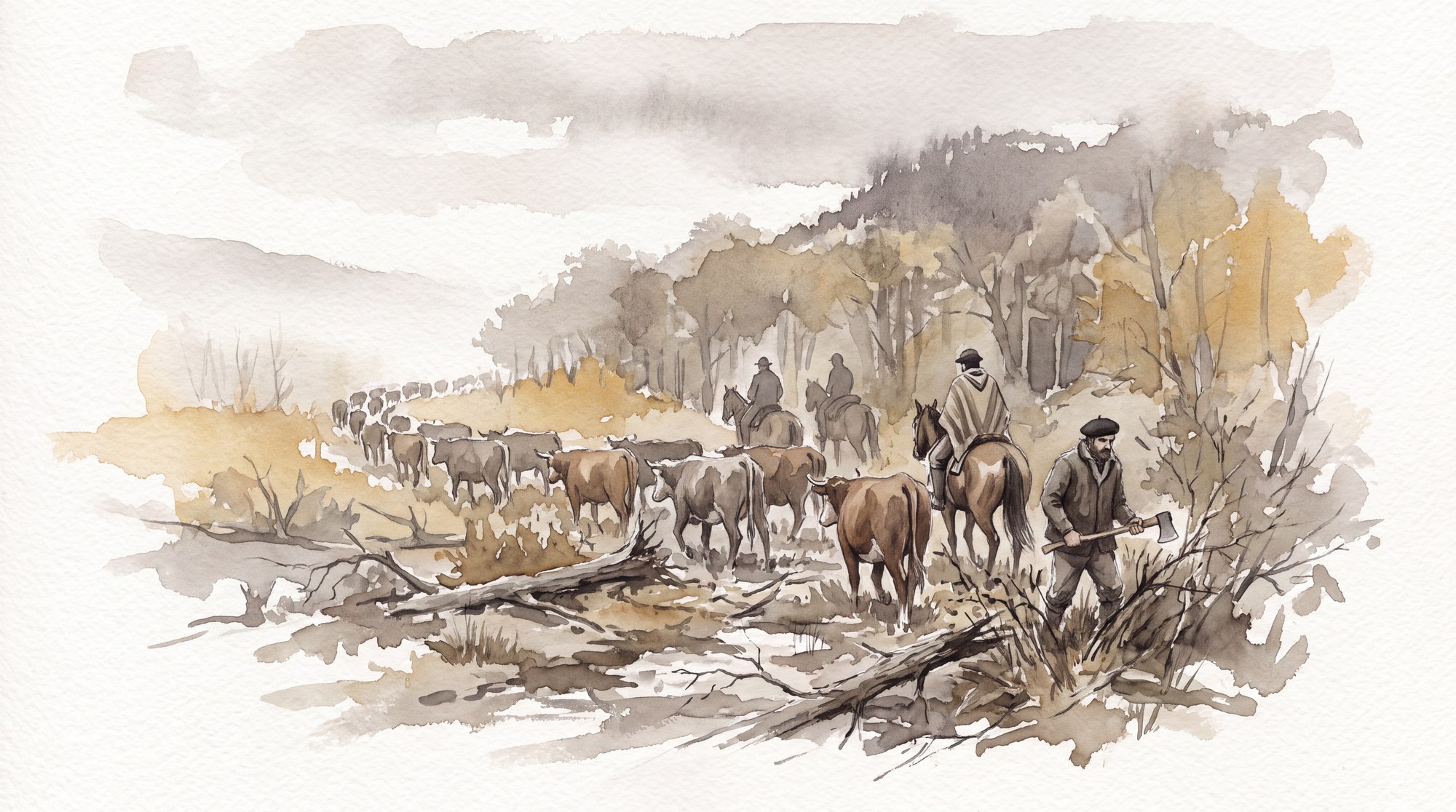
El baqueano Catalán, que cruzó la cordillera con su tropilla. Ilustración de Explora.The baqueano Catalán, who crossed the range with his string of horses. Illustration by Explora.
En 1885, doce hombres llegaron caminando a Ushuaia desde el Seno Almirantazgo, y nadie supo por dónde habían pasado.In 1885, twelve men walked into Ushuaia from Admiralty Sound, and no one knew which way they had come.
Lo anotó Thomas Bridges, el pastor anglicano a cargo de la misión, el 2 de noviembre de ese año: era «una partida de doce hermosos hombres de la Isla Dawson y alrededores», que había cruzado desde el Seno Almirantazgo hasta Lapataia. En octubre de 1889, el pastor John Lawrence anotó la llegada de otro grupo, de «indios Alaculoof», que había andado muchas millas a pie por montañas, valles y ríos, con pieles de guanaco como único abrigo. Las mujeres y los niños se habían quedado en Lapataia, a unas ocho millas de la misión.Thomas Bridges, the Anglican minister in charge of the mission, recorded it on November 2 of that year. They were “a party of twelve fine men from Dawson Island and its surroundings,” who had crossed from Admiralty Sound to Lapataia. In October 1889, the Reverend John Lawrence recorded the arrival of another group of “Alaculoof Indians,” who had walked many miles over mountains, valleys, and rivers, with guanaco skins as their only covering. The women and children had stayed behind at Lapataia, about eight miles from the mission.
Tres años antes de ese informe, en mayo de 1882, Giacomo Bove estuvo en la bahía Yendegaia y anotó lo que se contaba ahí. «La tradición recuerda que Iandagaia [Yendegaia] constituía un fácil medio de comunicación entre los fueguinos del canal Beagle y los del Almirantazgo», escribió, «pero cuándo cesó dicha comunicación se ignora completamente».Three years before that report, in May 1882, Giacomo Bove was at Yendegaia Bay and wrote down what was said there. “Tradition recalls that Iandagaia [Yendegaia] was an easy means of communication between the Fuegians of the Beagle Channel and those of the Admiralty,” he wrote, “but when that communication ceased is entirely unknown.”
«Probablemente éramos los primeros hombres blancos aquí»“Probably we were the first white men here”
Así que el paso existía, alguien lo seguía usando, y en los mapas no estaba.So the pass existed, someone was still using it, and it was not on the maps.
Zurueta, 1892
El primero que lo cruzó y lo contó fue un marino argentino.The first to cross it and tell of it was an Argentine naval officer.
A comienzos de 1892, el teniente de fragata Tomás Zurueta unió el canal Beagle con el Seno Almirantazgo por el valle Lapataia, acompañado por los ingenieros Eduardo Bestron y Carlos Waernet. No iba detrás de un récord: iba a acortar la distancia entre Punta Arenas y Ushuaia, que por mar eran 209 millas y que por este cruce bajaban a 140.In early 1892, the naval lieutenant Tomás Zurueta linked the Beagle Channel with Admiralty Sound by way of the Lapataia Valley, accompanied by the engineers Eduardo Bestron and Carlos Waernet. He was not chasing a record. He meant to shorten the distance between Punta Arenas and Ushuaia, 209 miles by sea and only 140 by this crossing.
Subió en bote por el río Lapataia unas trece millas y ahí armó campamento. Después siguió a pie, paralelo al río, cortando monte y faldeando cerros hasta la cabecera de la cuenca, y bajó por el otro lado hacia el norte hasta llegar al Almirantazgo.He went some thirteen miles up the Lapataia River by boat and made camp there. Then he went on foot, parallel to the river, cutting his way through the forest and working along the hillsides to the head of the basin, and descended the other side, northward, until he reached the Admiralty.
El problema es que casi nadie se enteró. Zurueta dejó poco registro y planos que no circularon, de modo que treinta años después el trayecto seguía sin estar claro. Lo había cruzado, pero no quedó escrito dónde.The trouble is that almost no one found out. Zurueta left few records, and his maps never circulated, so thirty years later the route was still unclear. He had made the crossing, but where was never written down.
Los que entraron desde el norte, en el lago FagnanoApproaching from the North, at Lake Fagnano
Mientras tanto, otra búsqueda avanzaba desde el norte, por el valle del río Azopardo.Meanwhile, another search was under way from the north, through the valley of the Azopardo River.
En febrero de 1896, Otto Nordenskjöld entró desde el Almirantazgo, remontó la orilla sur del Azopardo y, a unos cuatro kilómetros del lago Fagnano, se metió por un valle que se abre al sur y que hoy se llama Intimani. Desde las alturas vio el río Betbeder y nada que sugiriera una conexión con el Beagle, de modo que volvió al Almirantazgo sin alcanzar su objetivo.In February 1896, Otto Nordenskjöld came in from the Admiralty, went up the south bank of the Azopardo and, about four kilometers from Lake Fagnano, turned into a south-facing valley now called Intimani. From the heights he saw the Betbeder River and nothing to suggest a connection with the Beagle, so he returned to the Admiralty without reaching his goal.
En el verano de 1908 llegó otra expedición sueca, la de Carl Skottsberg, con Percy Quensel, Thore Halle, Albert Pagels y un ayudante de apellido Müller. Esta sí encontró el paso.In the summer of 1908 came another Swedish expedition, Carl Skottsberg's, with Percy Quensel, Thore Halle, Albert Pagels, and an assistant named Müller. This one did find the pass.
Remontaron el río Azopardo hasta el lago Fagnano, entraron hacia el sur por el valle del río Betbeder, tomaron al este por el río Toledo —un afluente que entonces no tenía nombre— y siguieron su curso hasta el nacimiento. Ahí, hacia el sureste, dieron con un portezuelo a 700 metros de altitud y le pusieron nombre.They went up the Azopardo River to Lake Fagnano, headed south into the valley of the Betbeder River, turned east along the Toledo River—a tributary that had no name at the time—and followed it to its source. There, to the southeast, they came upon a pass at 700 meters above sea level and gave it a name.
«Probablemente éramos los primeros hombres blancos aquí», escribió Skottsberg. «Nos han dicho que antiguamente los indígenas solían cruzar las montañas desde el Azopardo hasta el canal Beagle, pero no sabíamos si esto era cierto o no; si lo hubiera sido habrían utilizado nuestro paso, el Paso de las Lagunas, como lo denominamos. Fue un poco frustrante no haber podido divisar el Canal Beagle.»“Probably we were the first white men here,” Skottsberg wrote. “We have been told that in old times Indians used to cross the mountains from Azopardo to the Beagle Channel, but we do not know if this be true or not; if so, they would have used our pass, Paso de las Lagunas, as we call it. … It was a matter of some disappointment that we did not see the Beagle Channel.”
Del otro lado del portezuelo vieron un lago hacia el este y lo llamaron Löwenborg. El Beagle seguía sin aparecer.On the far side of the pass they saw a lake to the east and named it Löwenborg. The Beagle was still nowhere in sight.
Al año siguiente lo intentaron los salesianos, cuando monseñor José Fagnano encargó a Luis Carnino buscar una ruta terrestre entre el Almirantazgo y la misión de Río Grande. El grupo entró por la orilla norte del Azopardo hasta el lago. Al ver que no llegarían a Río Grande, pensaron en seguir hacia Ushuaia. Desde la altura vieron los glaciares que habrían tenido que atravesar. «Si seguimos, por más que tengamos la brújula podemos extraviarnos», dijo Carnino, y dieron la vuelta. No llegaron a Río Grande. Tampoco a Ushuaia. El 26 de marzo un vapor los recogió en el Almirantazgo.The following year the Salesians tried, when Monsignor José Fagnano asked Luis Carnino to find an overland route between the Admiralty and the Río Grande mission. The group went in along the north bank of the Azopardo as far as the lake. Seeing that they would not reach Río Grande, they considered pushing on toward Ushuaia. From the heights they saw the glaciers they would have had to cross. “If we go on, even with the compass we may lose our way,” Carnino said, and they turned back. They did not reach Río Grande. Nor did they reach Ushuaia. On March 26 a steamer picked them up in the Admiralty.
De Agostini entró en 1913 y siguió ampliando el mapa.De Agostini came in 1913 and went on extending the map.
Kent, 1922
En diciembre de 1922, el pintor norteamericano Rockwell Kent redescubrió la ruta de Zurueta y esta vez quedó documentada.In December 1922, the American painter Rockwell Kent rediscovered Zurueta's route, and this time it was documented.
Kent había llegado a Punta Arenas comprando por veinte dólares el bote salvavidas de un vapor naufragado. El viento lo tuvo semanas clavado en el extremo del Almirantazgo, así que decidió seguir por tierra. Desembarcó en bahía Blanca con un compañero, entró por el nacimiento occidental del valle Lapataia por un paso al norte del glaciar Dalla Vedova, y caminó unos cuarenta kilómetros por una cordillera desconocida, cargando cámaras, telas, pinceles y cuadros a la espalda.In Punta Arenas, Kent had bought the lifeboat of a wrecked steamer for twenty dollars. The wind kept him pinned down for weeks at the far end of the Admiralty, so he decided to go on by land. He landed at Blanca Bay with a companion, entered the western head of the Lapataia Valley by a pass north of the Dalla Vedova Glacier, and walked some forty kilometers through unknown mountains, carrying cameras, canvases, brushes, and paintings on his back.
Al segundo día encontró la prueba de que no era el primero. Había vuelto sobre sus pasos a buscar una gorra olvidada, y en el camino dio con los armazones podridos de dos refugios indígenas. «Supe en Ushuaia que, en años anteriores, cuando la misión inglesa de ese lugar estaba activa, habían aparecido ocasionalmente grupos que por alguna vía desconocida y difícil habían cruzado las montañas desde el norte», escribió. «Eran sin duda sus huellas las que habíamos encontrado.»On the second day he found proof that he was not the first. He had retraced his steps to look for a cap he had left behind, and on the way he came upon the rotted frames of two Indigenous shelters. “I was to learn in Ushuaia that in former years, when the English mission at that place was active, there had appeared occasional bands … who by some unknown and difficult way had come across the mountains from the north,” he wrote. “It was undoubtedly their traces that we'd hit upon.”
Los restos que encontró coinciden con el lugar que Bridges había descrito en 1885.The remains he found match the place Bridges had described in 1885.
Después Kent cruzó el río Lapataia frente a un puesto ovejero y siguió por el valle Vega Larga hasta la bahía Yendegaia.Kent then crossed the Lapataia River opposite a sheep outpost and continued along the Vega Larga Valley to Yendegaia Bay.
Con las entradas de Nordenskjöld y Skottsberg por el norte, y las de De Agostini y Kent, quedó demostrado que se podía unir a pie el Almirantazgo con el canal Beagle al menos por dos vías. Lo que sigue sin saberse es si los fueguinos usaban también el valle del Azopardo. Un detalle apunta en esa dirección: tanto Skottsberg como De Agostini encontraron manadas de guanacos en los pasos que descubrieron, y el guanaco busca los sectores libres de vegetación espesa.The journeys of Nordenskjöld and Skottsberg from the north, together with those of De Agostini and Kent, showed that the Admiralty could be linked with the Beagle Channel on foot by at least two routes. What is still unknown is whether the Fuegians also used the Azopardo valley. One detail points that way. Both Skottsberg and De Agostini found herds of guanacos in the passes they discovered, and the guanaco seeks out areas free of dense vegetation.
Don Cata y la ruta que se usaDon Cata and the Route in Use
Encontrar el paso y tener un camino son dos cosas distintas, y entre una y otra pasaron treinta años más.Finding the pass and having a road are two different things, and another thirty years passed between them.
Reinaldo Catalán Oporto nació en 1927 y llegó a caleta María a fines de 1954 para trabajar en el aserradero, con un dato en la cabeza. Antes de irse al sur había conocido en Osorno a un joven que hizo el servicio militar en Punta Arenas, y que le contó que los militares habían hecho una expedición al sur de la isla dejando la ruta marcada.Reinaldo Catalán Oporto was born in 1927 and came to Caleta María at the end of 1954 to work at the sawmill, with one piece of information in mind. Before heading south, he had met a young man in Osorno who had done his military service in Punta Arenas and who told him the military had carried out an expedition to the south of the island and left the route marked.
«Cuando llegué a trabajar al aserradero Caleta María a fines de 1954 busqué esa huella y la encontré, y en 1956 la seguí a pie hasta el lago Deseado», contó años después.“When I came to work at the Caleta María sawmill at the end of 1954 I looked for that trail and found it, and in 1956 I followed it on foot to Lake Deseado,” he said years later.
Nadie más andaba en eso. «En ese tiempo nadie hablaba de ninguna huella hacia [la estancia] Vicuña o Yendegaia», recordaba. «La gente trabajaba por el lago cortando vigas no más, no salían a buscar alguna huella pal monte. Nadie sabía cómo llegar a Vicuña, tampoco era un tema de conversación.»No one else was after it. “Back then nobody talked about any trail toward [the estancia at] Vicuña or Yendegaia,” he recalled. “People worked around the lake cutting beams, that's all; they didn't go out looking for some trail into the bush. Nobody knew how to get to Vicuña, and it wasn't something people talked about either.”
Con los años Catalán se convirtió en el baqueano de referencia de la zona, conocido como Don Cata. En febrero de 1966 arreó 81 vacunos y 15 caballos desde Cameron hasta el lago Fagnano. Desde el lago Despreciado subió un valle empinado hasta una laguna «de donde nace el río Alonso», y siguió ese río hasta el lago. En 1978 el gobierno de Chile financió la expedición Vicuña-Yendegaia para estudiar el trazado de un camino, la dirigió el ingeniero Hans Niemeyer, la guiaron Catalán y Francisco Oyarzún, y entre todos unieron las huellas existentes hasta dejar definida la gran ruta terrestre longitudinal del sur de la isla.Over the years Catalán became the area's leading baqueano, the backcountry guide everyone turned to, known as Don Cata. In February 1966 he drove 81 head of cattle and 15 horses from Cameron to Lake Fagnano. From Lake Despreciado he climbed a steep valley to a lagoon “where the Alonso River is born,” and followed that river down to the lake. In 1978 the Chilean government funded the Vicuña–Yendegaia expedition to study the route for a road. It was led by the engineer Hans Niemeyer and guided by Catalán and Francisco Oyarzún, and together they linked the existing trails until the great north–south overland route through the south of the island was defined.
Lo que había debajo de todoWhat Lay Beneath It All
En 2023, un proyecto que trabaja en el Parque Nacional Yendegaia encontró un sitio arqueológico con material lítico no local a unos diez kilómetros de Bahía Blanca. Material lítico no local significa que la roca con que se hicieron esas herramientas no está ahí, de modo que alguien la trajo desde otra parte.In 2023, a project working in Yendegaia National Park found an archaeological site with non-local stone material about ten kilometers from Blanca Bay. Non-local stone material means that the rock those tools were made from does not occur there, so someone brought it from elsewhere.
Quienes lo hallaron lo interpretan como un punto de contacto entre selk'nam, kawésqar y yámana, los pueblos originarios de la zona, en el mismo sector donde Kent encontró los refugios.The team that found it interprets it as a meeting point between the Selk'nam, the Kawésqar, and the Yámana, the Indigenous peoples of the area, in the same sector where Kent found the shelters.
El paso que Skottsberg bautizó de las Lagunas, viniendo del norte, es el mismo que desde el sur se llama Paso Baqueano Catalán. Un portezuelo con dos nombres, según de qué lado se llegue.The pass that Skottsberg, coming from the north, named de las Lagunas is the same one that is called Paso Baqueano Catalán from the south. One pass with two names, depending on which side you arrive from.
El camino que se construye hoy sube por el Betbeder y después por el Toledo, por una franja que quedó fuera del Parque Nacional Yendegaia, y sigue el mismo trazado que usaron los suecos en 1908. Se detiene unos ochocientos metros antes del portezuelo.The road being built today climbs along the Betbeder and then the Toledo, through a strip that was left outside Yendegaia National Park, and follows the same line the Swedes took in 1908. It stops about eight hundred meters short of the pass.
Pero el portezuelo es apenas la mitad del asunto. Del otro lado falta todo el descenso hasta el canal Beagle.But the pass is only half the story. On the other side, the whole way down to the Beagle Channel is still missing.
Ciento cuarenta años después del informe de Bridges, la cordillera fueguina sigue sin un camino que la cruce.One hundred forty years after Bridges's report, the Fuegian range still has no road across it.
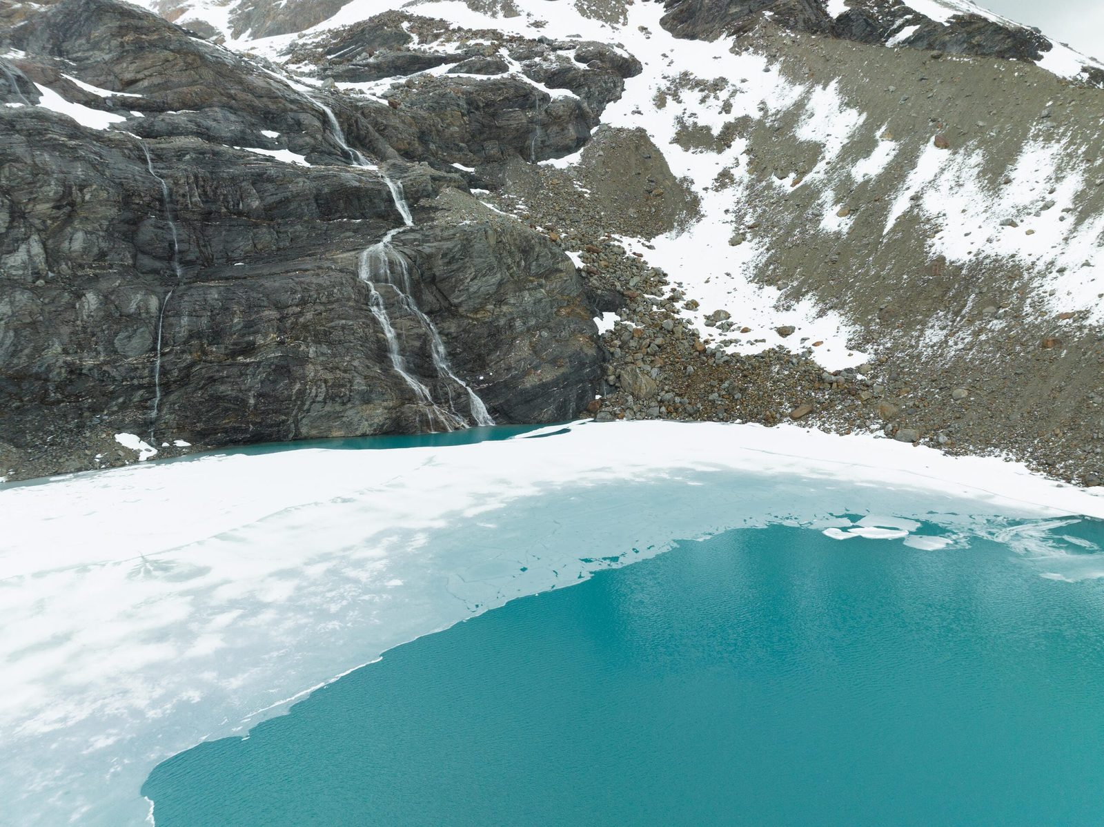
Laguna de altura al sur del Lago Fagnano, entre roca y nieve. Fotografía de Spafax, 2023.A high lagoon south of Lake Fagnano, between rock and snow. Photograph by Spafax, 2023.
7 fuentes7 sources+
- Explora. (2026). Rutas de exploraciones y puntos de interés de Tierra del Fuego [Conjunto de datos geográficos no publicado, archivos KMZ].
- García Oteiza, S. (2013). Vestigios patrimoniales del aserradero Caleta María, Tierra del Fuego (Chile). Magallania, 41(1), 53–82. https://doi.org/10.4067/S0718-22442013000100003
- García Oteiza, S. (2015). Los orígenes de las comunicaciones terrestres en el sur de Tierra del Fuego (Chile). Magallania, 43(2), 5–43. https://doi.org/10.4067/S0718-22442015000200001
- Rada, C. (2020). Recon: Cordillera Darwin. The wild mountains of Tierra del Fuego. American Alpine Journal. https://publications.americanalpineclub.org/articles/13201215548
- Universidad de Magallanes, Vinculación con el Medio. (2023, 27 de febrero). Proyecto artístico chileno Terra Ignota descubre «Paso de Indios» en el Parque Nacional Yendegaia [Nota de prensa].
- Valdés Gutiérrez, S. (2015). A public-private partnership for parklands. En T. Butler (Ed.), Yendegaia National Park. The Conservation Land Trust.
- Nota. Los testimonios de Thomas Bridges (1885), Giacomo Bove (1882), Carl Skottsberg (1908), Rockwell Kent (1922) y Reinaldo Catalán se citan según García Oteiza (2013, 2015).Note. The testimonies of Thomas Bridges (1885), Giacomo Bove (1882), Carl Skottsberg (1908), Rockwell Kent (1922), and Reinaldo Catalán are cited from García Oteiza (2013, 2015). Skottsberg and Kent are quoted in their original English; the other quotations are our translation from the Spanish.
Seguir por exploradoresMore on explorers
Glaciología · 8 minGlaciology · 8 min
La Cordillera Darwin y la latitud de NewcastleThe Darwin Range and the Latitude of Newcastle
En el norte de Inglaterra, a la misma latitud que la Cordillera Darwin, no hay un solo glaciar. Aquí, en cambio, bajan hasta el mar. ¿Por qué?In northern England, at the same latitude as the Darwin Range, there is not a single glacier. Here, by contrast, they reach all the way down to the se…
Historia · 5 minHistory · 5 min
La travesía de 2011 por la Cordillera DarwinThe 2011 Traverse of the Darwin Range
«Hay que estar loco de remate para pensar en cruzar la cordillera entera», advirtió Steve Ogle, que lo había intentado. En 2011, seis alpinistas franc…“You are raving mad to consider crossing the cordillera in its entirety,” warned Steve Ogle, who had tried it. In 2011, six French alpinists became th…